This interactive map will let you track loss of forest cover in any part of the world, including the Palani Hills. It’s been derived out of earth observation satellite data by researchers at University of Maryland, Google, and the US Geological Survey. The data for the map comes from the Landsat program, the longest continuously collected database of global satellite imagery.
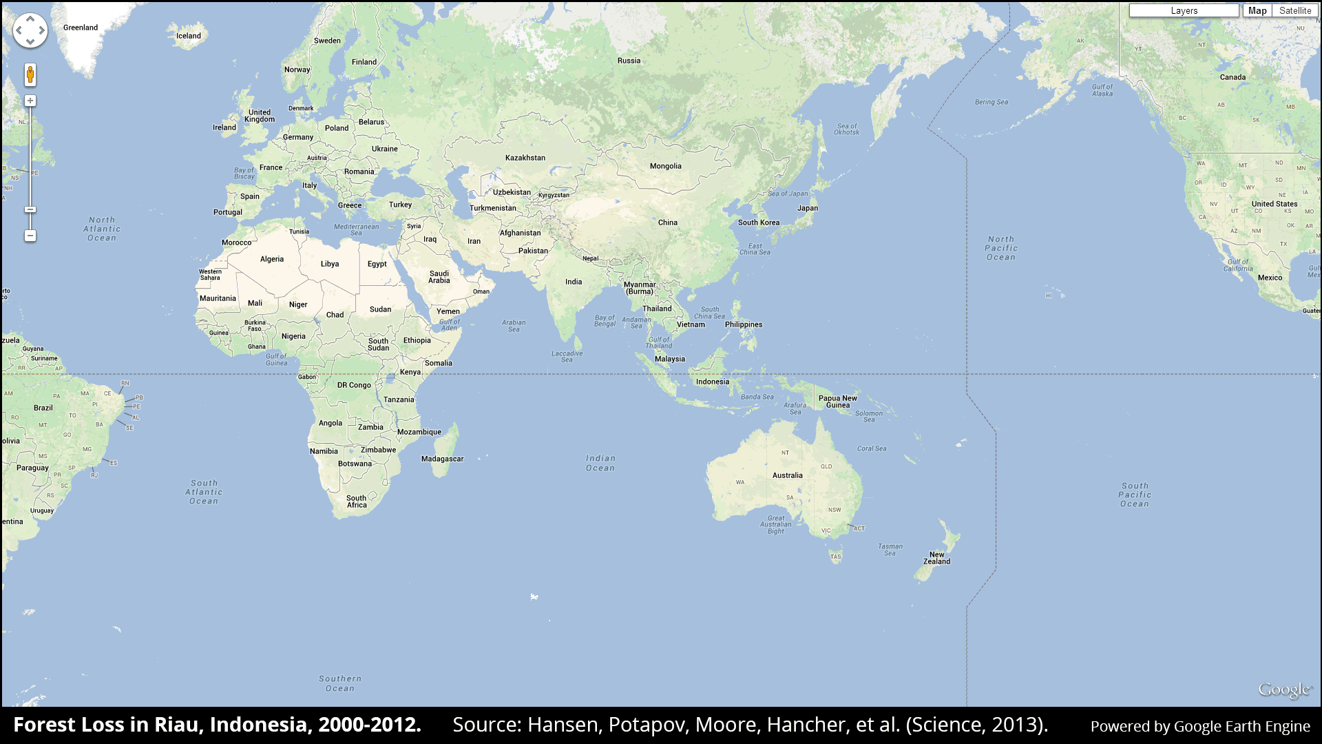
The 30-meter resolution scale of the map allowed the researchers to delve deeper into this trend, and explore why the tropics have experienced both high gains and losses. They discovered that Brazil was the country with the largest annual decline in forest loss over this period, while Indonesia had the greatest increase in forest loss.
“Losses or gains in forest cover shape many important aspects of an ecosystem including, climate regulation, carbon storage, biodiversity and water supplies, but until now there has not been a way to get detailed, accurate, satellite-based and readily available data on forest cover change from local to global scales,” University of Maryland professor Matthew Hansen, the lead author on the paper, said in a release.
Hansen said the new map was made possible when Landsat made its data archives open to free access in 2008. At the same time, the researchers were able to analyze the massive amounts of data by collaborating with Google and using its cloud computing capabilities.
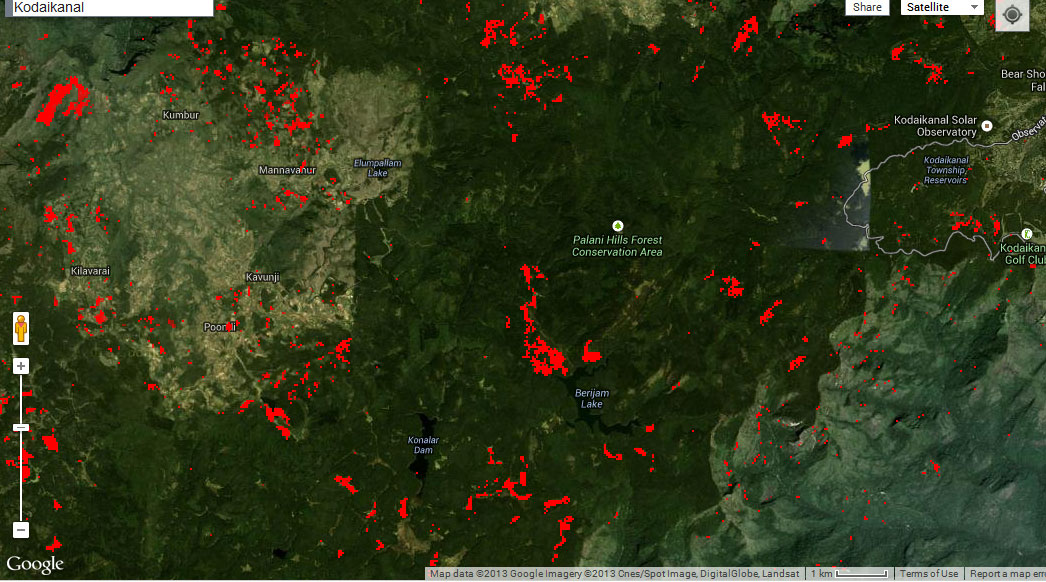
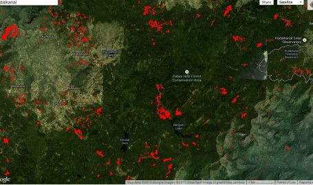
Forest loss around the Palani Hills conservation area in Tamil Nadu
The map has great local relevance as it can help track loss of green cover in reserve forest areas and track the impact of lumbering or mining or development – Indonesia and Paraguay seem to be some of the worst affected regions. Here’s a link to the research paper covering the study.